Ute Mountain Fire Lookout
Hiking Distance: 0 miles
Elevation Gain: Drive-up
Summit Elevation: 8,834 feet
Access: Ok gravel Roads
WillhiteWeb.com
Access:
In 1935, this fire lookout was built by the Civilian Conservation Corps Company 1965 which operated out of Camp F-35 on Sheep Creek, a few miles south of Manila, Utah. The CCC also built the road to the lookout.
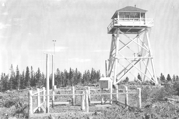
In 1937 a weather station was added to the site.
In 1940, the lookout was John Hampton.
In August 5, 1945: The lookout observer Buell Bennett detected a smoke. As soon as it was visible above the tree tops, the smoke was reported allowing Ranger Leslie Taylor to dispatch men from Manila and place it under control after it had burned over approximately five acres. Approximately 150,000,000 board feet of ponderosa pine saw timber was endangered by a smokers fire.
In 1948, a directive was issued to have a number one painted on the roof of the lookout cabin to aid aircraft in orienting themselves. This was done with the number being placed on the south side of the roof.
In 1951, the lookout was Levi Jr. Reed.
In 1960 a propane refrigerator was added to the lookout cabin.
In 1961, the lookout was Dale and Annamarie Harrison.
In 1962 and 1963, the lookout was Cedil and LaVoy Hill (and 3 year old son DeVon)
In 1964, the lookout was Lee Skabelund and his new wife Dixie Lee. The parents had to sign permissions for the marriage as Lee was 20 and Dixie was only 17. He shared the following. Supplies and food were purchased from either Manila or Vernal, Utah. A trip to town was taken every one or two weeks. Water was available at the Summit Springs Guard Station 2.5 miles to the east. The water containers were hauled up to the observation room using a pully-system. During clear evenings, when fire danger was low, the Firewatch spent time with the seasonal employees at the Guard Station for conversation and relaxation. Other pastimes included taking long walks, a favorite being to Browne Lake to the southwest for fishing, watching wildlife and writing. Each day during the tourist season, 3 to 6 groups of visitors would come to the tower to be shown the
In 1966, Fleet Stanton, highway engineer, evaluated the condition of the tower. He found the overall structure to be very sturdy, but indicated that several long deep cracks in the support timber could allow moisture to collect which may accelerate decomposition of the wood. He also recommended that railings be more closely examined and braced to with-stand sudden impact.
In 1967, Sigurd Nilsen estimated repair costs and determined the most economical course of action would be to replace the entire structure rather than concentrating on individual problem areas more prone to deterioration. Such action of total replacement would yield a structure which would require minimum maintenance in the future yet involve the destruction of a historically significant site. The lookout this year was Bill Self.
In 1968, Don Goodrich discussed the status of Ute Lookout Tower in a memo to
the Forest Supervisor. His study revealed only an average of 4 percent of the
fires in the area were being detected by the Ute Lookout. So, 1968 was last year utilized by Forest Service personnel for fire detection.
In 1969 the structure was closed to all public use. As it still housed radio equipment, the tower was periodically operated during certain fire conditions that year. At the end of season, the Ute Lookout sign at the main road junction was removed, the building was locked, and metal no trespass signs were posted at the base of the structure by District personnel.
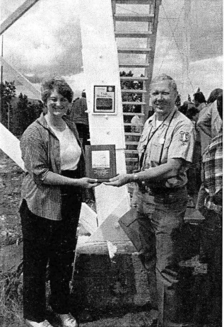
In 1978, the tower was nominated for the National Register of Historic Places. This was due to 1964 lookout Lee Skabelund coming back to work in Ashley National Forest and finding that the lookout was abandoned and in disrepair. He found help from Tish McFadden, the forest archeologist who helped gather the needed documentation to get it listed on the register, hence protecting it from being destroyed. He and others then went to work organizing numerous work parties to restore the lookout. As a protective and safety measure, the lower staircase of the tower was removed to prevent access up to the observation deck.
In 1980, the lookout was officially listed on the National Register of Historic Places.
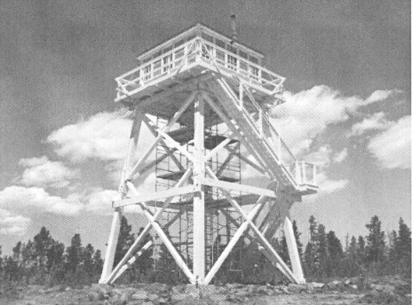
By 1984, most of the tower and cab had been restored. A dedication was done on Aug. 21.
In 1987, was another rededication and opened for public visitation.
In 2003, the Ashley National Forest sponsored a Passport in Time volunteer project and again repaired and replaced boards, windows, and roofing and painted the entire lookout.
In 2008 the Forest Service tested the tower legs for structural integrity and found extreme rot and deterioration in both the 1982 replacement sections and in the original tower sections. The tower was closed to the public until repairs could be made.
In 2011, the Forest applied for and received funding to replace the
tower.
In 2014, the restoration was finished and the tower was re-dedicated September 20.
The lookout is now used now as an interpretive site. It was the first and is the last standing fire tower with living quarters above ground in Utah. The tower offers a panoramic view of the Ashley National Forest, you can see over 360 square miles of virtually uninhabited northeastern slope of the Uinta Mountain Range.
The tower is located two and one-half miles west of Sheep Creek Geologic Loop. Take the turn off towards Spirit Lake, follow the signs. The road is unpaved but good enough for most vehicles. You could also hike up from Browne Lake.
Parking area for the lookout
Views to the Uinta Mountains
Views from Ute Mountain
The Ute Mountain lookout


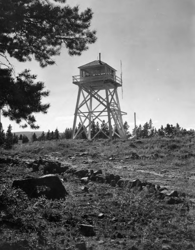
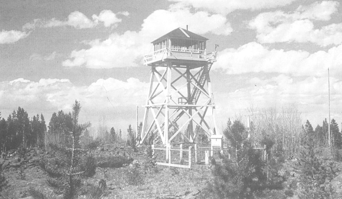
Ute Lookout in 1951
Ute Lookout in 1937
Lee and Dixie Skabelund getting a restoration award.
Ute Lookout getting some work done.
There are many more stories and pictures in the application for the National Register of Historic Places. It is available online.


