Fork Mountain Fire Lookout Site
WillhiteWeb.com
Status: Former Lookout
Elevation: 3,840 feet
Prominence: 779 feet
State: Virginia
County: Madison
Important Background Information
On 22 May 1926, Calvin Coolidge signed the bill stating that if Virginia deeded 327,000 acres of land to the federal government, Shenandoah would become a national park. To acquire the necessary acreage Governor Harold F. Byrd enlisted the help of his former campaign manager, William E. Carson, to head the newly established Virginia Conservation and Development Commission. The Commissions task was to survey, appraise, and purchase the properties within the proposed park boundary. As. chairman of this Commission, Carson persuaded President Herbert Hoover to purchase future parkland to be developed as a fishing camp. He hoped this presidential purchase would draw attention to the Shenandoah project and add cost-free acreage to the park.
If you have images of this site, please contact me.
Once Hoovers Camp was obtained:
William Carson arranged for the construction of the tower as a diversion for the Hoovers guests. He wrote to the Virginia state forester:
I want a tower built on Fort Mountain above the President's summer camp in Madison county, such as is used in Forestry operation for fire protection. This tower should be built with stairs on the inside, so that ladies could ascend it without danger. If you are short of money in your Bureau to do this, I will provide it. There is only one thing I want - that is action -- step on it! The deck of the tower should be large enough for a large party; the tower to be used not only as a lookout for fire protection, but for observation for the President and his friends. Hikes could also lead to the Hoover school or the tops of nearby mountains.
Located just outside the boundary of Shenandoah National Park, the park service included this in their list of fire locations that utilized park service funds. Newspaper articles and other documents from 1929 reveal some interesting facts about the purpose of the lookout making this a very unique and historic site.
Also:
Besides the attraction of the fire tower, topping Fort Mountain earned guests a special notation in the guest book. Myers wrote in his diary, Mr. Jason Yardley Rippin, of Ossining, N.Y. and I walked to top of Fort Mountain by the trail, in 55 minutes and back down the face of the mountain, following a telephone line, thus getting our names the guest book used for the purpose. Lovely view, but hazy.
(Fort Mountain)
Newspaper Articles:
September 10, 1929: A fire observation tower is to be erected at once on top of Fork Mountain, in Madison County, overlooking President Hoovers camp, according to announcement just made by District Fire Warden W. H. Stoneburner, of Charlottesville, who has just returned from Madison, where, in company with W. M. Utz, chief fire warden of that county, a trip was made to Fork Mountain and a site for the tower decided upon. The tower will be at the highest point on the mountain, and will command a view of a large part of the proposed Shenandoah National Park, on the east side of the Blue Ridge, and on clear days, Washington may be seen. The tower will be thirty-five feet high, and the observation chamber will be six by eight feet. Marines from the Presidents camp will assist in its erection, and will, when necessary, act as lookouts. The tower will have telephone connections and will be a protection to the Presidents lodge against fires. On days when visibility is low, airplanes will patrol the park area.
October 28, 1929: One of the three steel towers built this year by the State Forest Service is in Madison County on Fork Mountain, about a mile in direct line from President Hoovers summer camp. The tower directly overlooks the camp. This tower was constructed to facilitate forest fire protection in the proposed Shenandoah National Park Area, particularly near the site of the Presidents camp. But it also makes it possible for President Hoover and his weekend guests to secure a magnificent view of the surrounding mountains and valleys. This tower has been built 35 feet high and with an inside stairway to make an easy climb above the surrounding timber.
Survey History:
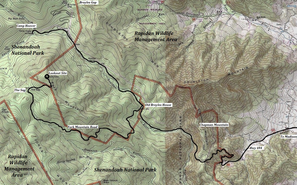
In 1874, the Coast Survey (CGS) visited the site. The access was described from Criglersville as the road over Chapmans Mountain (route 649 today) into the valley of the Rapidan River. Continue 6 miles to Mr. Broyles House. From the Broyles, follow the road built to the camping ground on the Sags (about 4 miles). From the Sags to the top is a path, distance about 3/4 mile. The top is small and has been entirely cleared.
In 1932 the Coast and Geodetic Survey returned Fork Mountain finding a fire tower at the summit. They replaced the station mark with a bronze disk under the east side of the lookout tower. They said the total climb by foot from Hoovers Camp was about 1.5 hours and 1,300 foot gain.
In 1954, the Army Corps of Engineers checked the station and found the fire tower had been removed leaving only the concrete footings. Two radio tower installations had also been installed. The presidents camp was also now used as a Boy Scout Camp.
In 1957, the Coast and Geodetic Survey returned again but this time called the summit Fort Mountain and said the 90 foot microwave tower was the Atlantic Seaboard Company. And that the cement foundations of the fire lookout tower remain.


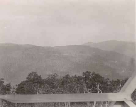
This is the view north on October 16. 1934
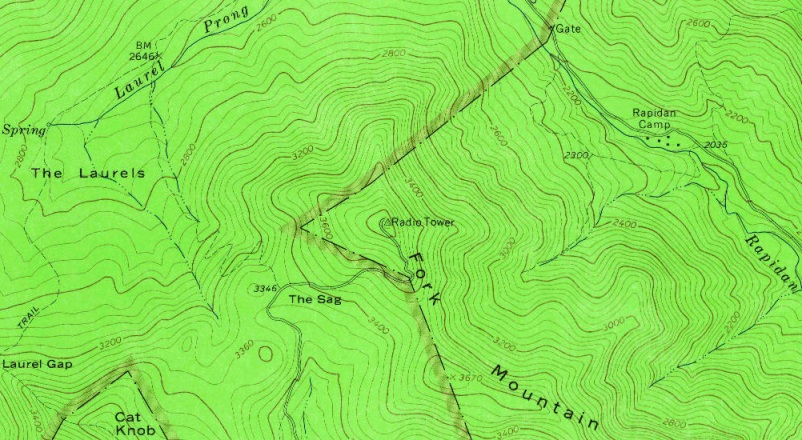
1965 USGS map showing just the radio towers
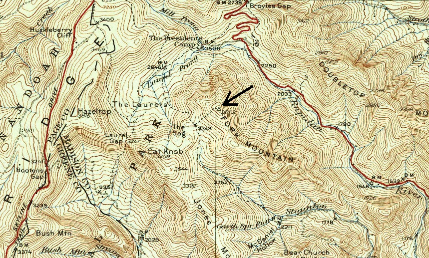
1933 map showing he trail from The Presidents Camp up to the Sag and then up to the summit
Current map showing the road to The Sag and up to the lookout site.


