Solduc Lookout Camp
WillhiteWeb.com
Lookout Elevation: No visit yet (reported at 4,375)
Hiking Distance: No visit yet
Elevation Gain: No visit yet
Access: No visit yet
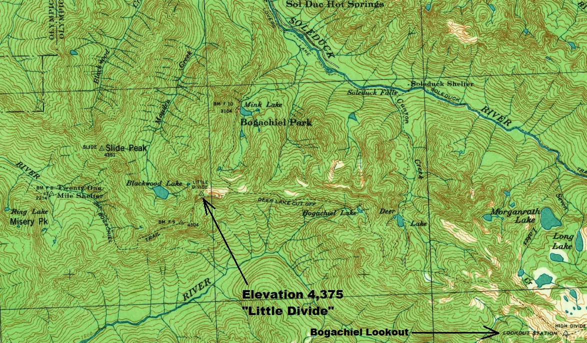
The existence of this lookout site is based on the Kresek Inventory. The Kresek inventory places a Sol Duc lookout 11 miles south of Lake Crescent at point at 4375, which was the elevation of Little Divide on maps in 1939 (current USGS maps shows elevation at 4379). The inventory also says a camp in 1919, abandoned in the 1930s. I have a hunch that this camp on Little Divide may not have existed but it is just a hunch, and would quickly go away if we could find any evidence that a site did exist on Little Divide.
When the Kloshe Nanich Lookout site was built in 1919, there was no name for the mountain, even today, no name. During this early period, the mountain Kloshe Nanich was located was given several names by all the media. The Washington Forest Fire Association reported that the lookout was built on Solduc Mountain. The Sol Duck River and Valley are directly below Kloshe Nanich, and the lookout was in the Solduc Burn. So, although no Solduc Mountain exists that we know about, the name was used to identify where the Kloshe Nanich lookout was at. It seems possible that old records that Ray found for the inventory were referring to Kloshe Nanich.
Possible reason this lookout called Solduc did not exist:
In 1917, lookout structures hardly existed on the peninsula. The only lookouts on the entire Peninsula was Finley Peak at the south end of the mountains, Blue Mountain at the NE end of the peninsula, and Kloshe Nanich at the NW end. NO other lookouts were built that we know of for 10 more years. It seems coincidental that in 1919, a camp was established on Little Divide, and called Solduc, the same name given to the mountain that Kloche Nanich was at. There is just a 14 mile separation between the two.
Imagine the Time Period
1939 USGS

