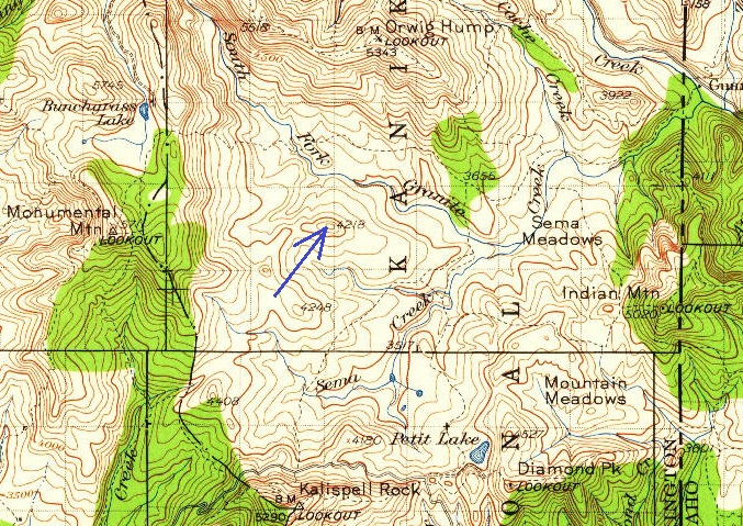
South Fork Mountain Lookout Site
In 1935, a 40-foot pole tower with a L-4 cab was constructed.
In 1936, the tower and cab were abandoned.
Given the short usage timeframe, I was not able to find any maps with this lookout site labeled. This low elevation lookout had 5 other lookout sites within a 4 mile radius. Orwig was just 2.3 miles north, Monumental was 2.6 miles to the west, Kalispell Rock was 3.4 miles to the south, Indian was 4.1 to the east and Diamond Peak was 3.8 to the southeast. Every single mountain next to this site had a lookout at some point.
Lookout Elevation: 4,203 feet (newer maps) 4,218 (older maps)
Hiking Distance: Have not visited yet
Elevation Gain: Have not visited yet
County: Pend Oreille
WillhiteWeb.com
1934 USGS (1959 update)

