Raft River Ridge Lookout Site
WillhiteWeb.com
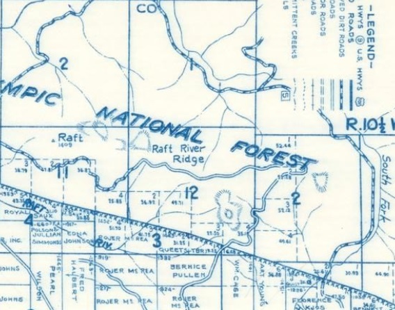
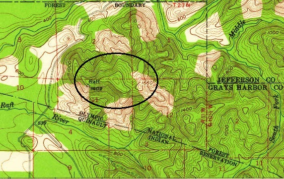
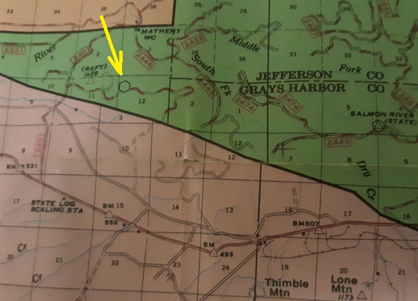
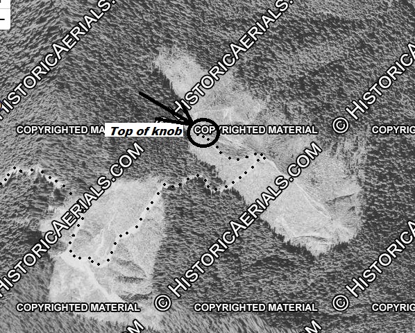
Lookout groups have been visiting the site near the Raft River Banchmark for numerous years, according to Leslie Romer. She provided the detailed maps below and explained that it was possibly an emergency trailer based on old timers stories. No artifacts were ever found by groups looking in the area in early 2000s. Some recent photos have allowed us to pinpoint the specific site, or at least the general area, and it does match with being in Section 12 as the maps show. Raft River Ridge is rather long so without the pictures, there was some uncertainty if the maps were accurate. One of the new found photos also shows a simple firefinder stand over a stump. With road access to the top of the knob in the 1950s, the emergency trailer and firefighter stand seems likely here.
Lookout Elevation: 1,540 feet (knob top 1,640 feet)
Hiking Distance: Drive-to or 2.5 miles from the gate
Elevation Gain: 940 from the gate
County: Grays Harbor
Location: NW1/4 Section 12
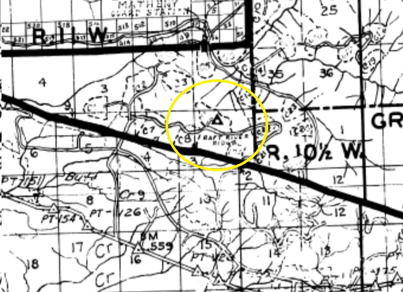
1953 aerial shows the 1660 knob logged off and no roads to the highest knob
1962 Metsker with Raft River Ridge in Section 12
1956 USGS with the knob labeled as elevation 1660 and cut areas in white
1977 National Forest Map. Although the map has no legend, other National Forest maps show a hexagon as an inactive lookout. An active lookout is a triangle within a hexagon, as shown on the map with Salmon River (State) lookout. Location correct in Section 12.
1960 district fire map with fire lookout icon (solid color triangle with hole in the middle). Located correct in Section 12
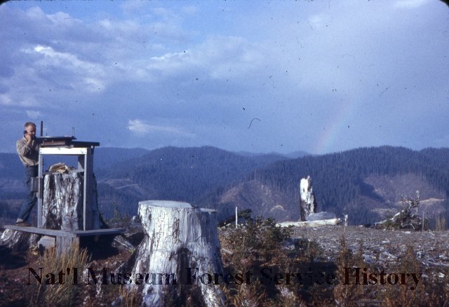
Labeled as Raft River Lookout Site 1957. Ron Welsh photographer also shot photos from nearby Higley Peak Lookout around same time in 1957. I had difficulty pinpointing the background mountains until the black and white picture on the right was found in a different collection. Matching the second image was much easier with the additional topography in the shot. Below are some comparisons with pictures taken in 2022.
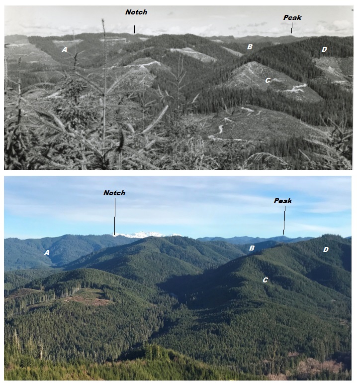
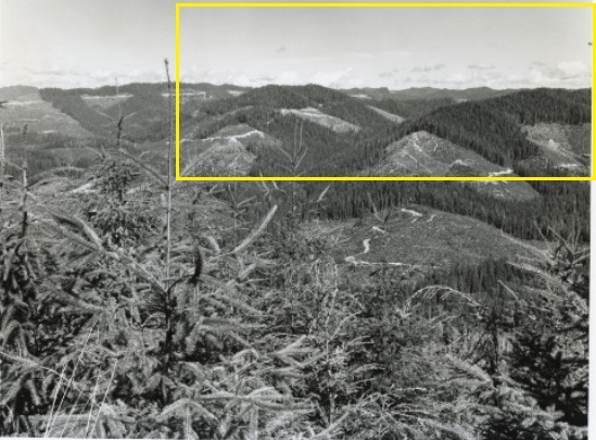
The yellow box is what is visible in the picture to the left
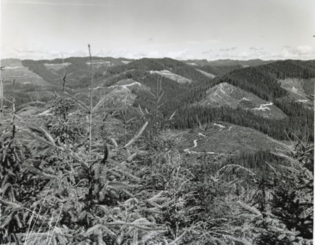
September 24, 1964. Picture from the lookout site thanks to Harold Weaver. He was a forester who took hundreds of photos on the Olymmpic Peninsula of tree stands and documented tree growth, fire and harvest methods.
January 2022
Access:
The site is on Quinault Tribe land and access seems to vary from year to year, or possibly hunt vs non-hunt periods. When restricted, signs will say No Trespassing and I do know security patrols this area. There is also a gate at the connection with the general public and paved West Boundary Road.
Note:
The Kresek Inventory (mistakenly) suggests Raft and Salmon River might be the same.
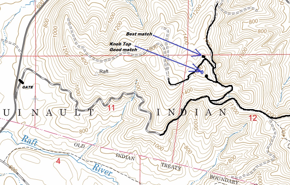
Map of the access with 2 locations marked where the lookout site was at.

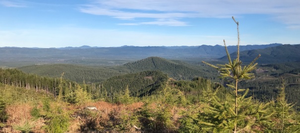
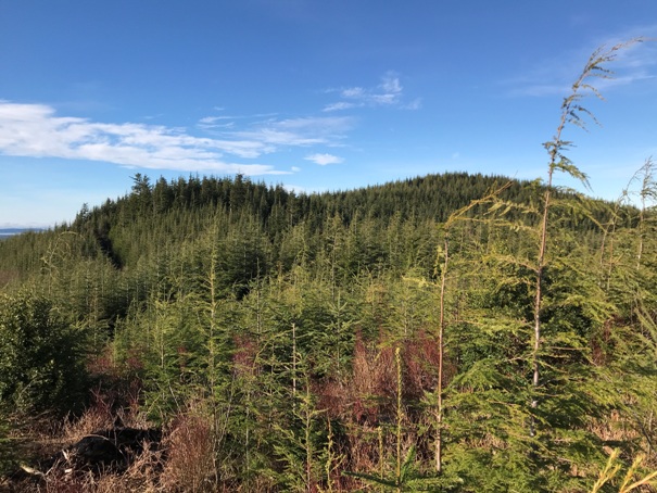
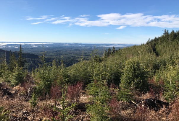
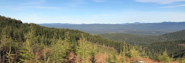
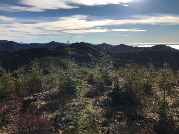
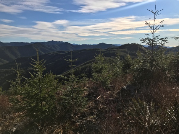
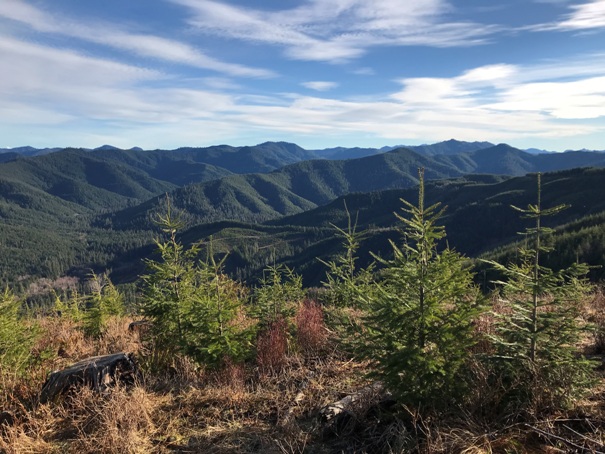
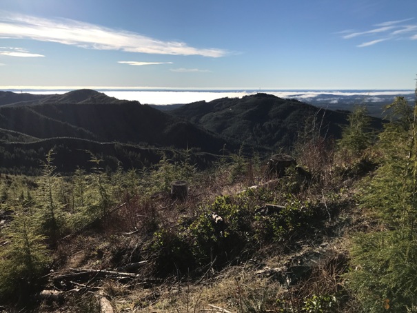

Below: The label for the 1964 black and white photo near top of page.
Looking South and Southwest at the Raft River Ridge highpoint
Looking Northeast from the knob
Looking East from the knob
Looking Southeast from the knob
Looking North-Northeast from the knob
Looking Northwest across the wide Queets River Valley. Probably Mt. Octopus on the horizon line, Kloochman Rock on right horizon.
Zoom in of the Mt. Olympus peaks


