Wauchecha Bald Lookout Tower
Wauchecha Bald Lookout is the first real detour to a lookout site that might test a persons resolve to visit towers on their Appalachian hike. Although under a mile each way, the uphill of an extra 600 feet at this point might be mentally taxing when you have Fontana Dam just ahead calling you. The Appalachian Trail used to pass beside it before being rerouted west of the tower.
WillhiteWeb.com
Status: Standing Lookout
Elevation: 4,364 feet,
Prominence: 1,231 feet
State: North Carolina
County: Graham
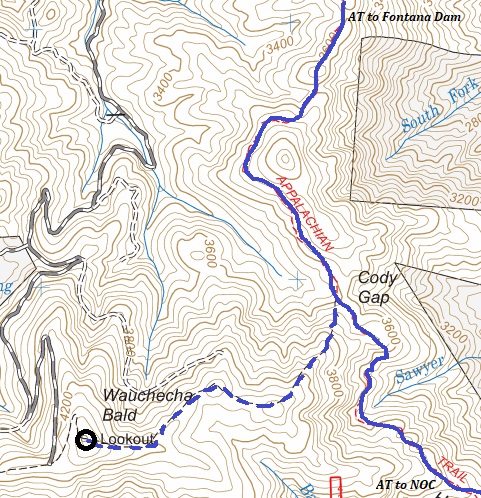
AT Access: 0.85 mile detour with 600 feet of gain
Mile Marker: 155.9
Lookout History
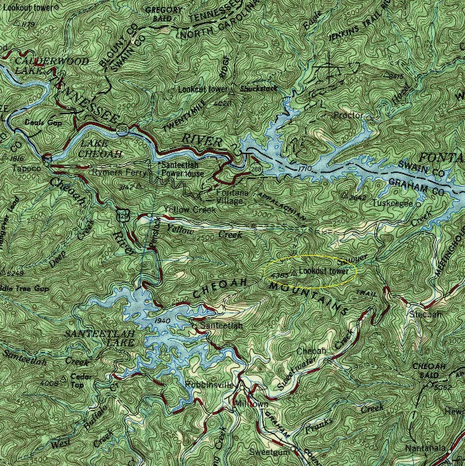
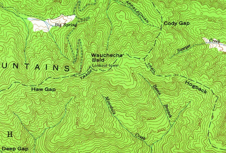
It is not clear when it was built. It did not show up on maps until the mid-1950s.
A 1933 Smoky Mountains Hiking Club did not mention the tower during an AT work hike that year. They did say that it was easy trail building and jokingly said all they really needed was a lawn mower.
In 1963, a USGS survey party described the tower as a 30-foot steel tower. It was likely built in the 1940s and one source says the CCC built it sometime between 1933 to 1942.
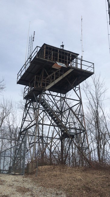
Wauchecha Bald Fire Tower is an Aermotor live-in-cab tower of a style purchased primarily by the U.S. Forest Service. It is approximately 35 feet tall with a 13x13 cab and catwalk. It has all-metal construction, with storm shutters, and a pyramid hip roof with standing-seam metal roofing. The bottom steps have been removed, and all glass is broken or missing. Shutters have been torn off, but are mostly stacked inside the cab.
According to a local historian and retired watchman, The Wachacha Bald (note difference in spelling) is said to have been named for a Cherokee man by the name of Jack Wachacha who lived in a small cabin on the level flat before the steep climb to the tower. Wachacha is said to mean grasshopper in the Cherokee language. People spoke of seeing him there in 1913. He had a garden fenced in with a rail fence head high to keep free ranging livestock out. Wachacha Bald had a much larger open grassy area in those days and people would herd their sheep there in the summer, according to local history.
If you have more information about this site or images, please contact me.


1961 USGS map
1955 USGS map
Showing the detour route from AT to the lookout site
Photo by Victoria Oliver 2019


