Mount Katahdin Lookout
WillhiteWeb.com
Status: Former Lookout (NE4000er)
Elevation: 5,268 feet,
Prominence: 4,288 feet
State: Maine
County: Piscataquis (County Highpoint)
AT Access: Trail to the top.
Mile Marker: 2194.3
Lookout History
In 1913, the mountain was established as a lookout station. The living quarters was described as a wooden ground house on a ledge on Abol Slide, where hikers had often camped in route to the summit. It was built by Frank Sewall, who also served as the watchman. It became known as the Sewall Camp or cabin.
The 1916 Forest Commissioners Report said that in 1915, five miles of wire with insulators, iron rods for uprights, hammers and drills were bought for the construction of the telephone line to the top of Katahdin.
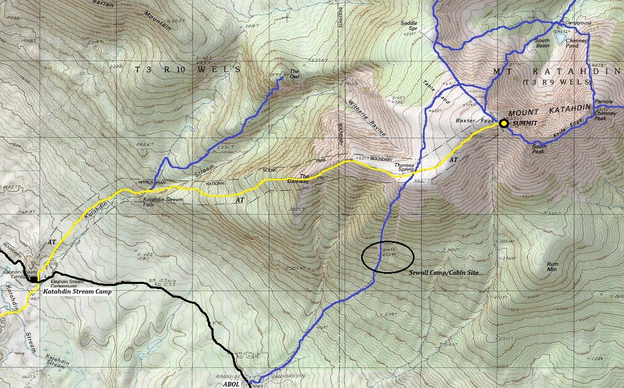
This report says that the observations were taking place from the summit. I have seen much speculation that the Sewall Cabin was the observation/lookout site at roughly 3,300 feet but that makes no common sense, living quarters were very often down below treeline. The only documented evidence we have is this 1916 Commissioners Report. Given this, I have to take it at its word until more evidence presents itself.
In 1920, Katahdin was abandoned due to severe weather conditions. The Sewall cabin was used by hikers for several more years before it collapsed. After abandonment, it was known as the Watchmans Camp.


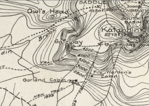
1923 map by J. E. Havelin of Katahdin area. Shows the Fire Wardens Cabin around the 2,800 level of the mountain on the Abol Trail.
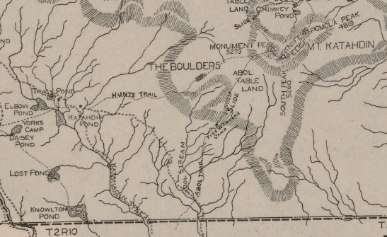
1922 Katahdin Park Game Reserve map shows Fire Wardens Camp site
More images after my visit in 2024

Appalachian Trail route up Katahdin shown as yellow.


