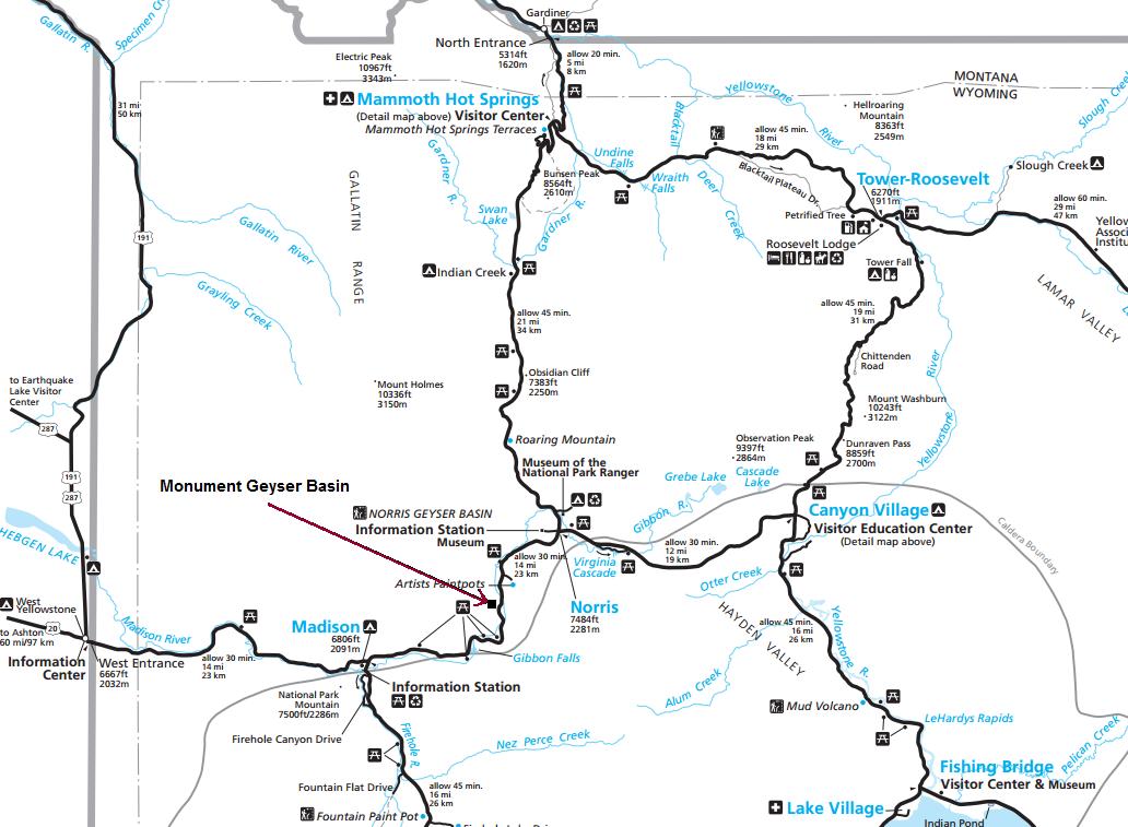
Monument Geyser Basin
Elevation Gain: 700 feet
Distance: 1.3 miles
Monument Geyser Basin is a hydrothermal area that requires a hike to reach, which means you're less likely to find a crowd at this site. It isn't all that spectacular but it's location located up on a high hillside is rather unique. There are steam vents, chimneys and hot pools, enough to find it interesting. Along the way are some views over the trees to the Gibbon River and distant Mount Holmes.
Yellowstone National Park
The trail starts off quite innocent, meandering along the Gibbon River with the road on the opposite side. But soon the trail starts its uphill 700 foot climb through a young forest to the hidden basin. After all the switchbacks, just as you reach Monument Geyser Basin, a viewpoint out on the left allows you to look down where you are parked, on the Gibbon River. Going right accesses the basin, where you can explore around....just be careful, there are no fences here to block you from doing something stupid like breaking thin crusts and getting burned.
The trailhead is located 4.7 miles south of Norris Canyon Road on Route 89, and 8.6 miles north of Madison Junction. There is a sign and pullouts on both sides of the Gibbon River Bridge.
This small geyser basin is one of the strangest spots in the park. Although the basin has no active geysers, its monuments are made of siliceous sinter and appear very similar to the siliceous spires found on the floor of Yellowstone Lake. Scientists think that this basins structures formed from a hydrothermal system in a glacially dammed lake during the last stages of the Pinedale Glaciation.
Park Service Notes:
Trail
Access


Gibbon River from the trail
Viewpoint down into the Gibbon River Valley
Trailhead
First part of the trail along the Gibbon River


