In 1945 the Washington Forest Fire Association put a lookout at this location. The 38th Annual Report of the Washington Forest Fire Association said, the Association built one new lookout tower on Lucas Creek, in Section 35, Township 14 North, Range 1 East, thus filling in a gap between observation points. The Weyerhaeuser Timber Company cooperated in this construction, by bulldozing approximately a mile of road to the summit, and transporting one of their cabins to the top, for use of the lookout man.
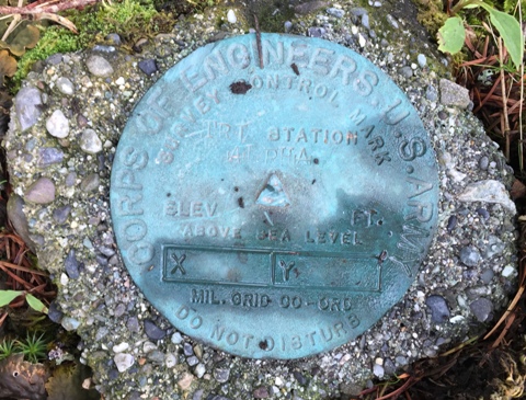
The 1947 Alpha Benchmark data sheet says about the benchmark, "it is on the summit of a bald, logged over hill, on which is located a state of Washington lookout tower and cabin. It is about 180 feet north of the cabin and the highest point of the hill".
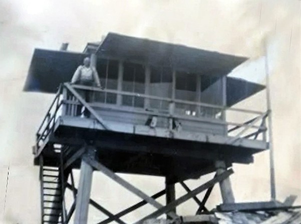
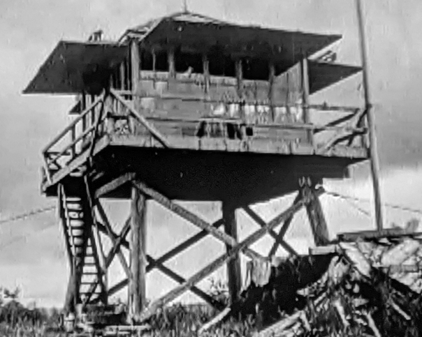
In 1950, a 12-foot timber tower with a 14 foot x 14 foot cab was constructed as a replacement for an earlier tower. (Biennial Report of the Forestry Division)
In the early 1950s, James Robert Fitzhugh was the lookout for several years. The images of the tower and the sleeping cabin were provided by his granddaughter. Her family would enjoy visiting him while he was at the lookout. The family tells a story about Grandpa and his Stew. He would make a batch of stew and never throw it away, just adding more ingredients and more water as he went along. It was sort of a family joke that Thankfully, none of the family ever got sick. It was the granddaughters recollection that the lookout slept in the ground cabin, not the tower.
On June 5, 1964, we learn from a Chehalis newspaper (The Daily Chronicle) that Mrs. Fred (Rosalie) Hendricks of Onalaska was stationed at the fire lookout station.
The lookout inventory says the lookout was removed in 1967.
Elevation: 2,116 feet
Distance: 3.7 miles one-way (from gate)
Elevation Gain: 1,400 feet (from gate)
Access to gate: Paved
Washington Fire Lookouts
Access:
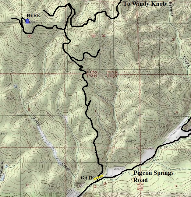
Located inside the Weyerhaeuser Vail Tree Farm, a recreation access permit is needed to legally visit this site. A motorized permit will allow you to drive to the summit. Non-motorized permits still pricy but there are many lookout sites in the Vail Tree Farm. From I-5, take highway 508 east past Onalaska to Centralia/Alpha Road. A short distance further is the Pigeon Springs turn-off. Drive to the Weyerhaeuser Gate one mile up Pigeon Springs Road.
My visit in 2018
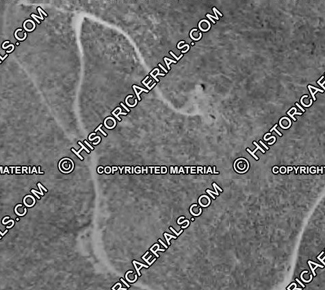
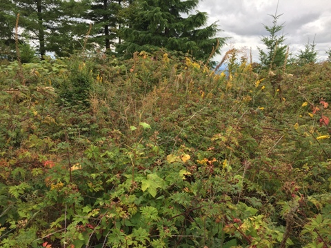
At the summit, the road has been extended a short distance down the back. Based on the 1952 aerial, there was structures on both sides of the road as you reach the highest point of the road. Currently, the scotch broom on the right side and the blackberry bushes on the left side are hiding any remnants of the lookout. Due to the berries on the summit, a bear has been building trails and sleeping in the grass at the former site.
Leslie Romer has visited the site numerous times and before the area was harvested she found the cement footings around 2003. Upon returning around 2010 and 2016 all that she found was the cement steps and a block which had been moved. You can find these artifacts to the NE of the well marked benchmark (which is below the standing trees on the summit).
Lucas Creek Lookout Site


Abernathy Mountain
Boisfort Peak
Walville Peak
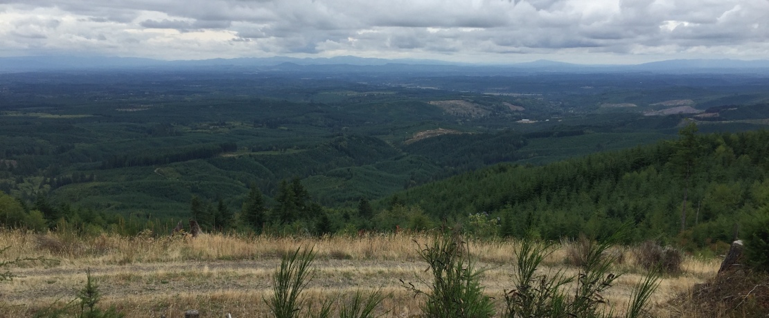
Looking southwest from the benchmark
Looking west from the benchmark
Looking southeast from the benchmark
1950 Washington Division of Forestry Report
1952 Aerial
Access Map
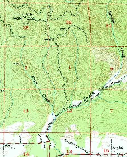
1978 USGS showing Alpha benchmark
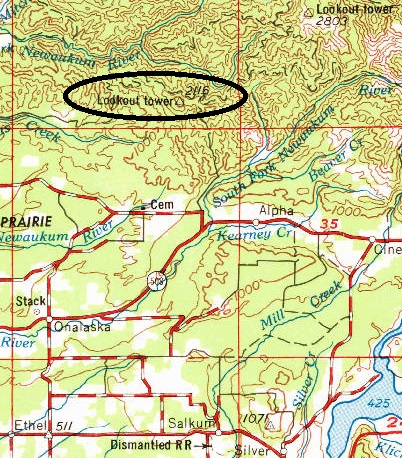
1969 version of the 1958 USGS map showing Lucas Creek Lookout
Brush on the summit with the benchmark trees in back
Alpha Benchmark
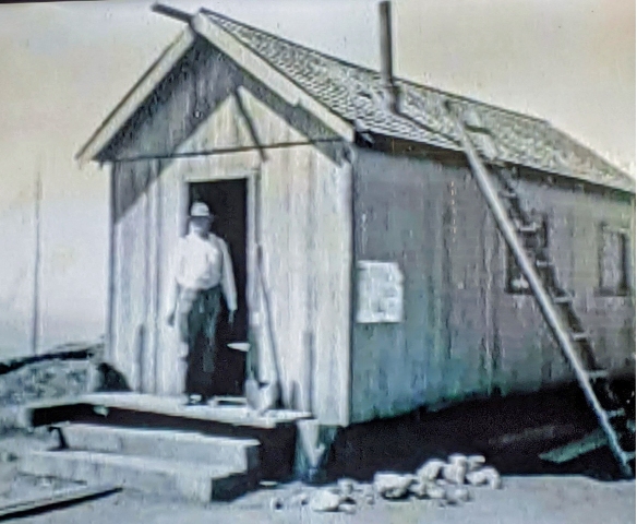
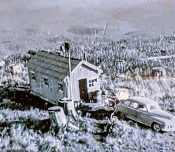
James Robert Fitzhugh at the cabin front door
James Robert Fitzhugh on the lookout
Lookout around 1950ish
Lookout cabin provided by Weyerhaeuser, likely a former logging bunkhouse


