

Dempsey Hill Lookout Site

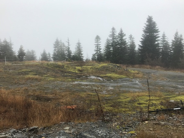
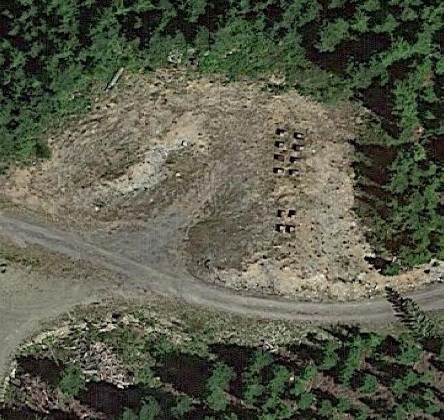
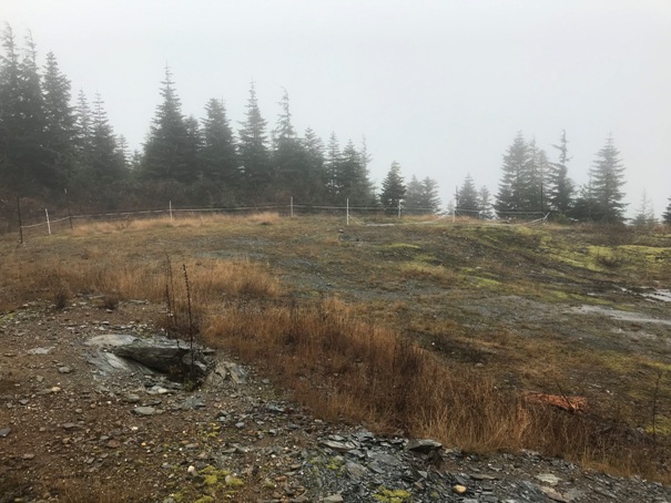
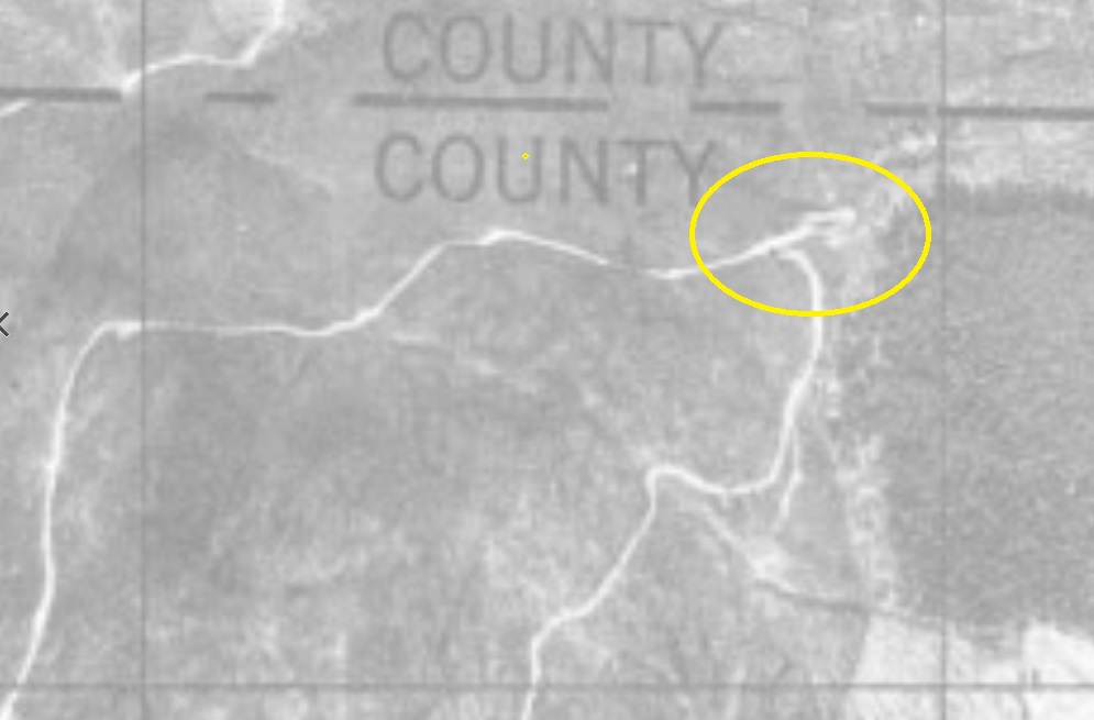
This lookout site is based on one piece of paper found in the AWS files in the Seattle Archives. When the Army was looking at potential sites during 1942, they had several State and Forest Service lists of lookouts. One list shows a Dempsey Hill Lookout in section x of xx range xx West. The document also says that the site is on the side of a hill but the trees had been cleared in all directions except south where Lymn Hill blocks the view anyway. Looking at aerial photos from the 1940s, only one road existed and it had a large opening in the only real spot that would match or work given the description. That is where I went. Today, there isnít much to see but a large open staging area for logging trucks. In route to Dempsey Hill, you pass the Wickersham AWS site which may have also been used for fire covering the views on the other side of the mountain.
Lookout Elevation: 3,100 feet
Hiking/Biking Distance: 7.2 miles
Elevation Gain: 2,800 feet
Access: Any vehicle
Access
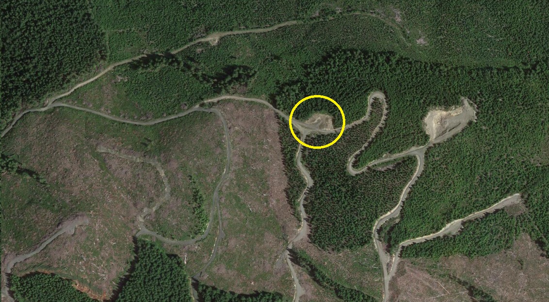
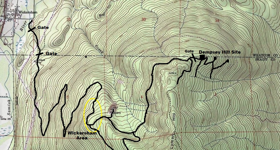
From the small town of Wickersham, follow Wickersham Road to a large bend where it turns left becoming Innis Creek Road. Instead, turn right onto a dirt road and follow to a gate. There is parking near the gate. This road is part of the Pacific Northwest Trail. Use map provided to reach the spot.
WillhiteWeb.com: Fire Lookouts

Bee hives on the hill
List of State and Private Lookouts given to AWS planners in 1942. Dempsey Hill with a 10 foot platform pole tower with no cover. Views cleared to the North, Northeast and Northwest. Mountain is to the South. Site located on slope of a hill.
The open area on the ridge that has been cleared since 1940 that has views in all directions but South, and has road access.
Access map to Dempsey Hill site
Recent aerial photo showing the site
1944 aerial photo showing the site


