

Elevation: 1,258 feet, prominence is 638 feet
Distance: 1.5 miles
Elevation gain: 750 feet
Landowner: Private Timber Company
Grays Harbor County
Burnt Hill Lookout Site
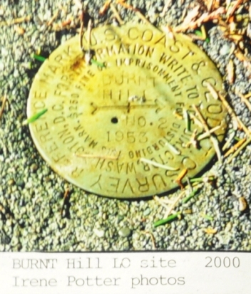
Survey descriptions help identify the location. The structure was at the highest point shown on the map shown with a benchmark and elevation of 1,258 feet. If you can find the reference mark number 2 disk, you can take a back-azimuth of south 51 degrees east, and then measure 72 feet. This gets you to the original benchmark. Now measure 45 feet east and you are in the center of the lookout tower. Irene Potter found the reference disk in the year 2000 so it might still be around. It was reported to be 8 feet west of the road; about 2 feet lower than the original highpoint.
Use as a Aircraft Warning Service Station
Location of Structure
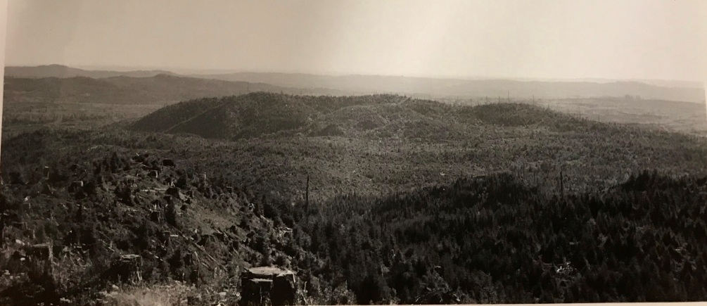
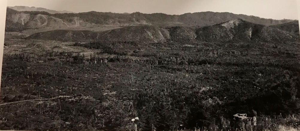
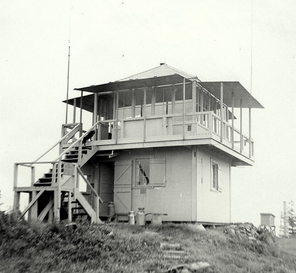
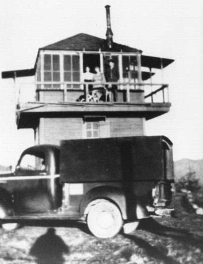
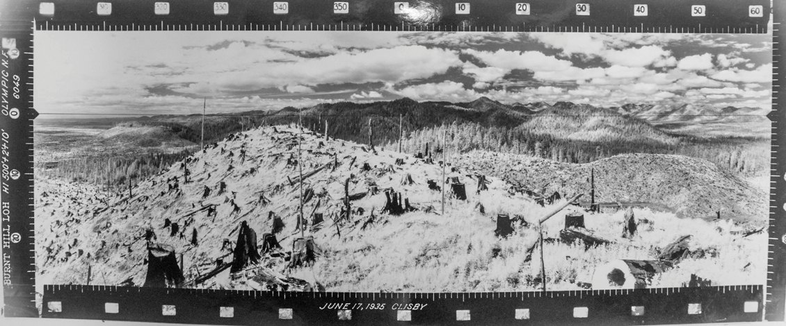
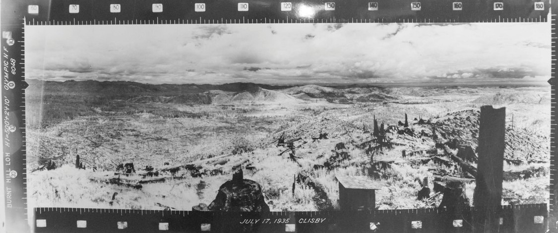
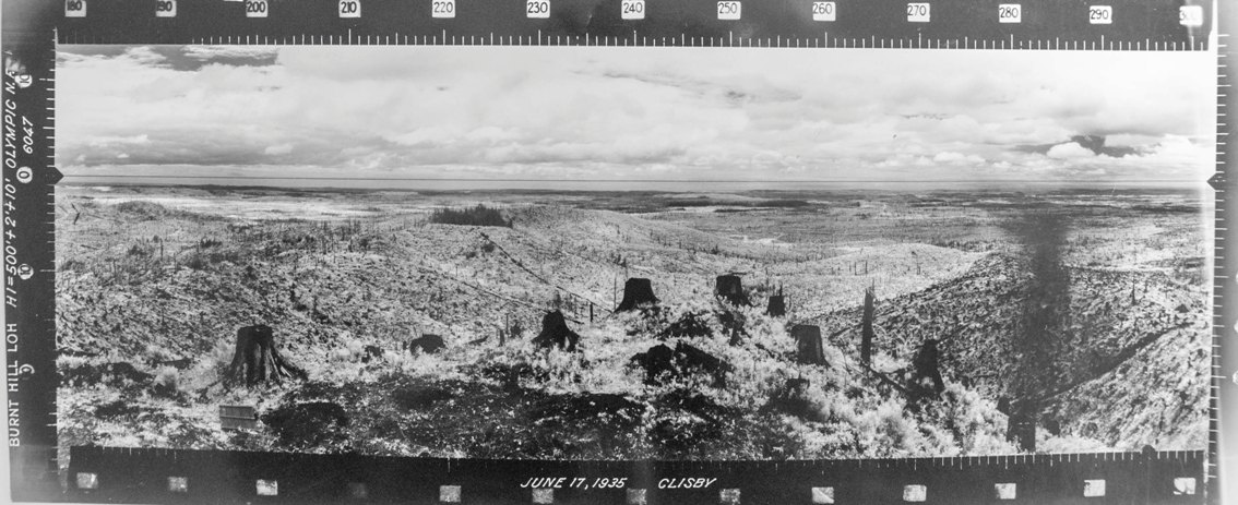
This lookout first shows up on 1930 and 1932 maps. In 1935, the summit was photographed during the Osborne photo survey project. From these photos, we see a completely harvested and burned off summit and surrounding area, a possible explanation for the name Burnt Hill. The photos were taken from a 10 foot cab that we only learn about because of images taken by the timber company in 1940 and 1943. There is also a shed nearby in the 1930 and 1940 photos. By 1942, this was a 2-story lookout with a first story enclosed 10-foot tower. The cab was a wood 14 x14 standard R-6 plan. In 1943 a 6x8 foot wood shed and 4x4 foot toilet of wood was constructed. In 1958, the lookout was turned over to the State. In 1959, the DNR erected a 40 foot live-in tower. It was removed in 1969.
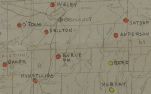
From numerous documents shown below, we learn the Aircraft Warning Service Station (Baker 7-1) was located on private property owned by the Polsen Lumber Company under a free verbal use agreement starting March 10, 1942. The AWS station utilized existing facilities owned by the Olympic National Forest although they were winterized. Very little expense was paid out for additional improvements. At the end of service the site was retained by the Forest Service for continued use as a fire detection station. The site was used year-round and there was an access road to the summit. Communication was to the Quinault Exchange. The AWS observers were Clarence and Marie Locke.
Washington Lookouts
Benchmark Highlights
The benchmark was described in 1953 at 45 feet west of the center of the U.S. Forest Service Lookout Tower which is located on the summit of Burnt Hill. The lookout tower is a two story wooden structure which is 14 feet square and 20.7 feet in height. The base of the tower is 1.07 meters higher than the triangulation station Burnt Hill. In 1970, a recovery note said the station (benchmark) has been destroyed and the lookout house was torn down in 1969, and will not be replaced. In 1974 the foundation block of the lookout was still there.
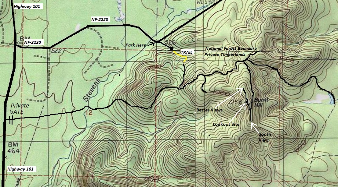
From Humptulips, go north to Forest Service Road 2220 (Newbury Creek Road) and turn right. Go 1.2 miles to a Y just after Stevens Creek. The right at the Y goes onto an abandoned road that is still drivable. Park at the Y. You could drive up but there is little room when the short spur dead-ends at at the washout.
Access
Route
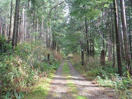
Walk the road a short distance to Stevens Creek. From there, follow a trail to reach the road on private timberlands. This short section of trail has a creek crossing. When you reach it, be sure to note the trail you are on because there is another hidden trail that comes in at the exact same spot. When you reach the main road system, follow the map and you will find your way to the summit. (Technically the upper road system requires a permit but go during non-hunting season and your unlikely to have problems).
In the papers
On May 18, 1956 the Port Angeles Evening News said, "The Quinault District has been on patrol as needed and also is manning Burnt Hill Lookout during the present dry period. Burnt Hill Lookout covers an area of thriving second growth timber and some old burns have come in heavy to bracken fern. It also covers some of the logging operations in the lower Humptulips country.




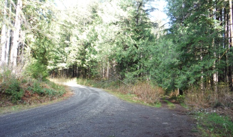
The short dead-end Forest Service spur
Park here at the Y on the FS-2220 Road
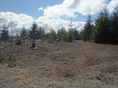
Lookout site today


Burnt Hill Lookout 1940s
Burnt Hill Lookout
1932 Olympic Trail Guide
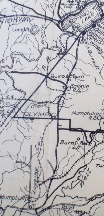
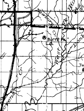
1930 map
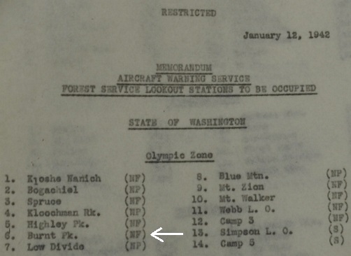
A.W.S. Station Map
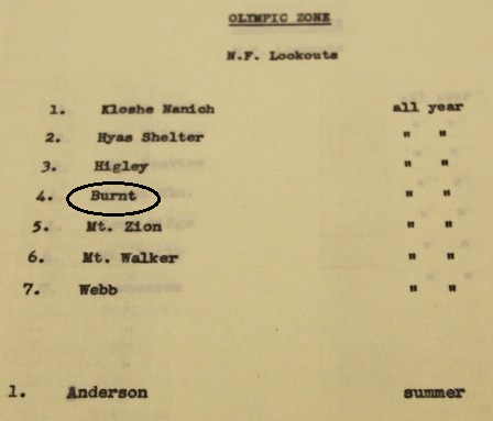
Forest Service Lookouts prior to AWS
To be used year-round by AWS
Access information
Communications to the Quinault Exchange
Zone, Agency, Observation Post, Mailing Address, Employees and Titles
Burnt Hill access map
Burnt Hill run by Olympic NF, on Polson Lumber Company with a verbal lease, an existing station with free use, winterized, to retain for the Forest Service. Very little AWS funds were involved.
Looking North - June 17, 1935
Looking North - 2017
Looking Southwest - June 17, 1935
Looking Southwest - 2017
Looking Southeast - June 17, 1935
Looking Southeast - 2017
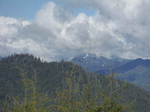
A distant Stovepipe Mountain to the northeast
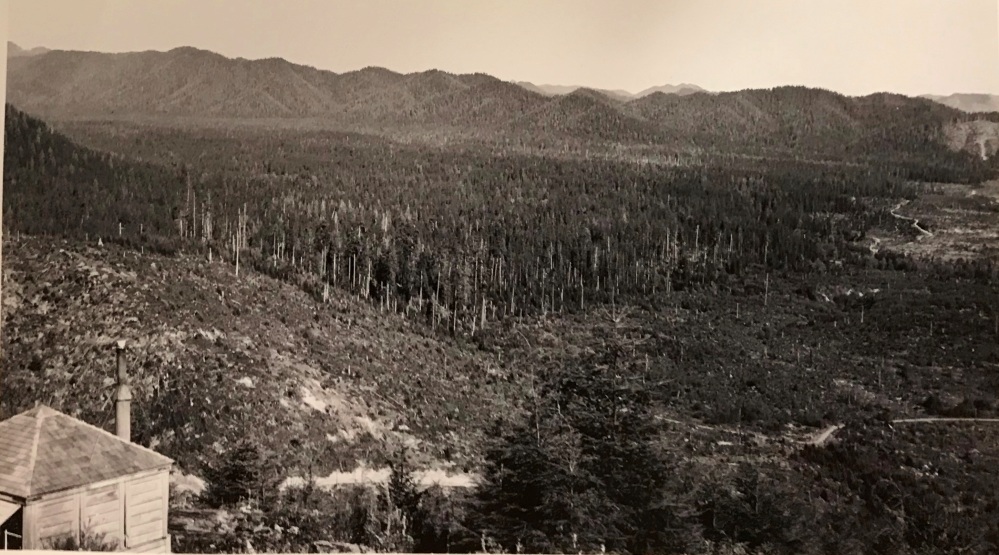
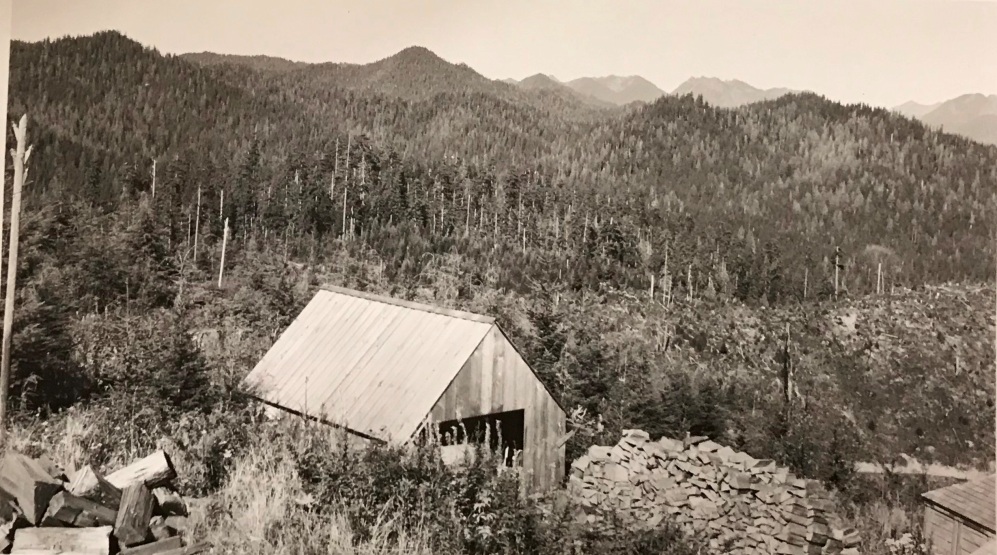
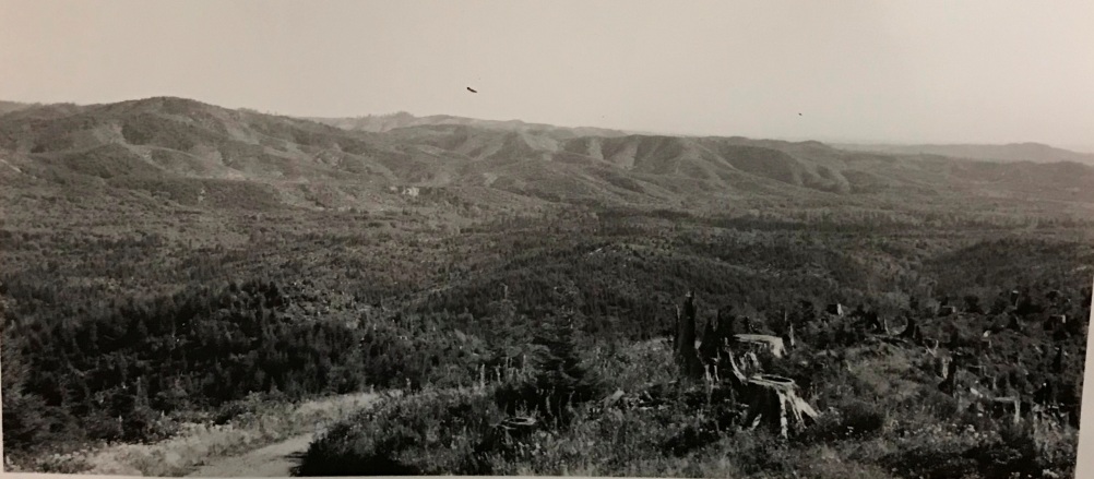
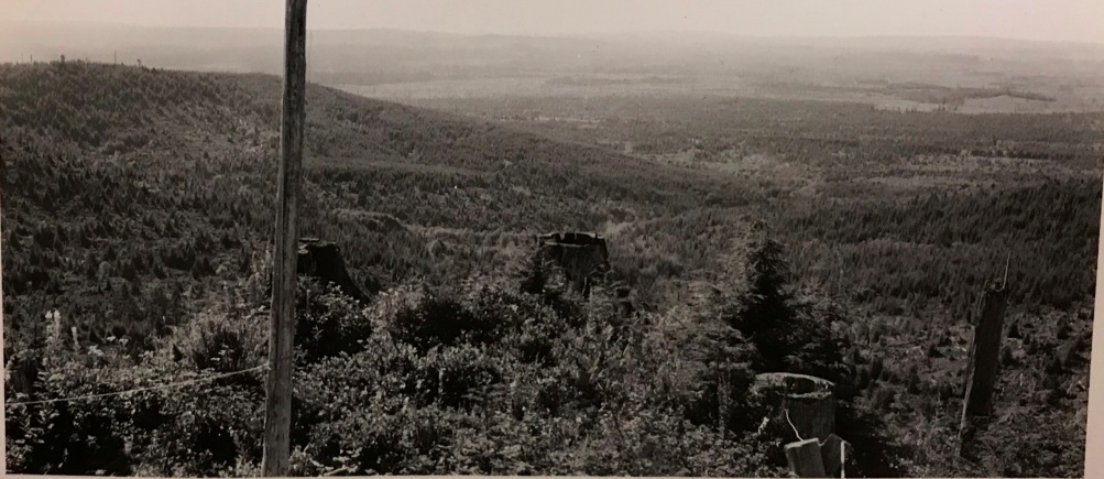
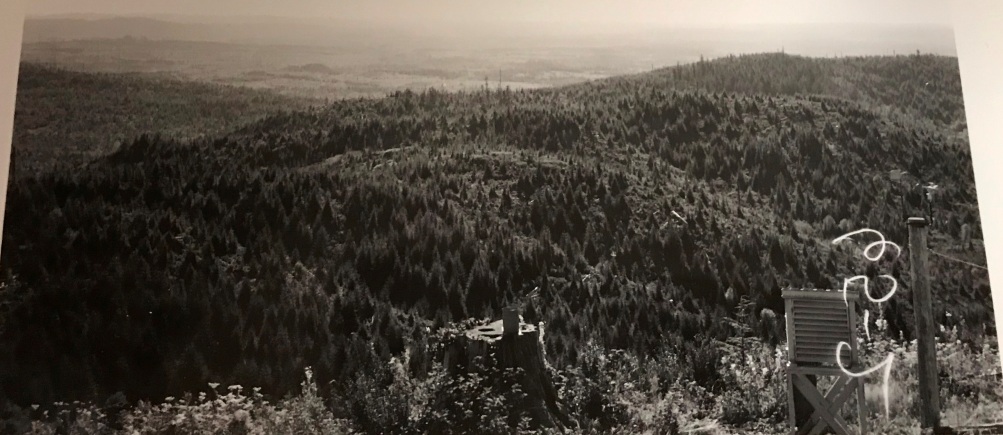
Looking Southwest - 1943
Looking North - 1943
Looking Northwest - 1943
Looking Southeast - 1943
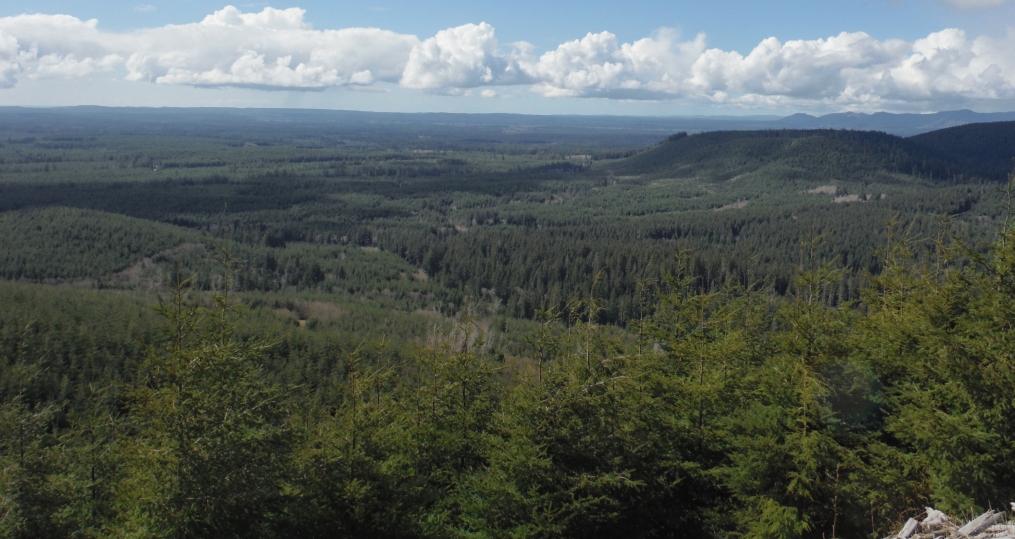
Looking Northwest - 2017
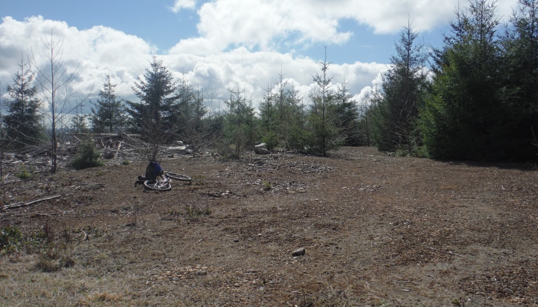
Big clearing at the top


