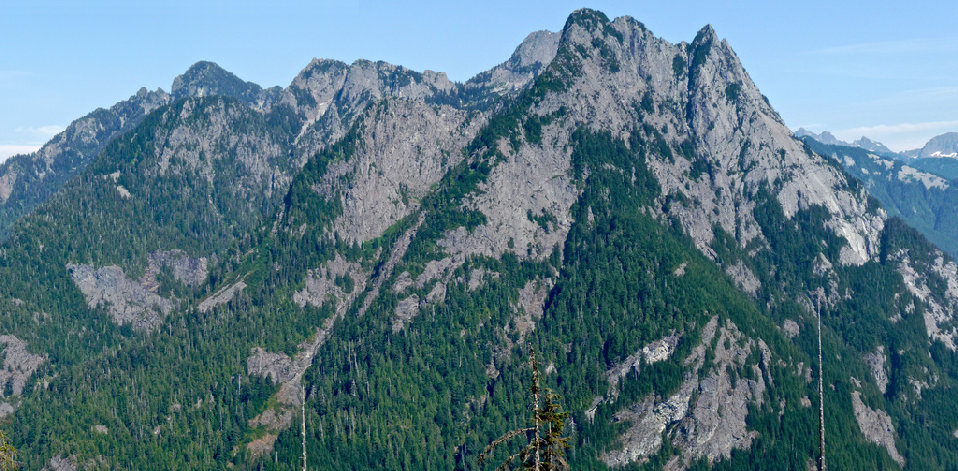
Quartz Mountain is one of the more lonely mountains in the very popular Middle Fork Snoqualmie Valley. It's slopes have probably rejected more attempts than summits. It's not that climbers aren't making it due to technical difficulty, it would be more out of frustration, lack of time, lack of desire. To want Quartz is to have a passion for summits, for a challenge of oneself, to submit yourself to monotonous forest, full knowing there are much better places you could be climbing. But there is hope, while compiling information for this page, I see a new route with more ascetic beauty has been pioneered.
This is the story of Quartz Mountain, a diamond in the rough, a waiting adventure for anyone who dares, who willingly might spill some blood, sweat and tears. Ask anyone who's been up, they will have a story to tell you. Why climb it? Most I know who have either had a desire to climb all the Middle Fork Peaks or were trying to complete the Home Court List. Quartz just happens to fall at the very bottom of the list at #100
From Interstate 90 take Exit 34, turn left under the freeway, pass Seattle East Auto Truck Plaza, turn right on Middle Fork Road, and drive about 9 miles and park off to the road just after a rocky outcropping. Anywhere in the next mile is fine as well. If you hit the Middle Fork Trailhead, you went too far. Another starting point is at Road 120, at 9.8 miles. Drive in on this road as far as you can, then walk it, eventually hitting the old CCC road (now trail). This starting area is always changing, have a map, be prepared for....new trails, roads, squatters. The area is improved. This was once the Seattle landfill, for the local losers who couldn't afford going to the dump. They weren't afraid to work for their dollars though, they were hard at work in these parts making Meth. And when you return to your vehicle now, it's likely to still be there, with all it's windows intact too.
Quartz Mountain
Distance: 2 miles
Elevation Gain: 3,600 feet
Summit Elevation: 4,641 feet
Access rating: Level 2
www.WillhiteWeb.com: Your online resource for hiking, climbing and travel

Access:
SW Ridge Route:
Somewhere along the old CCC road/trail, you'll need to start bushwhacking, as shown on the map. Your goal is to get on the ridge which becomes more defined the higher you go. The hardest part is near the beginning where you can see the contours are very close. Maybe it's better to the north but then you will be doing more traversing to get onto the ridge. This is really bad second growth forest. The trees are tight in places and brush bad in spots as well. Higher on the ridge, you'll enter old growth forests and the going gets much better. Although, I hear rumors there is still bad brush in places. Plan a spring ascent and the snowpack is easy walking up there through the old growth. At 3900 feet on the ridge, start a traverse to the right toward the small lake shown on the map. From there, climb the final summit knoll. Now according to the map, this isn't the summit....but, most agree that if you are standing there, it is much higher than point 4641 to the east. A traverse between the two is doable if you want to be sure.


Thank you puzzlr, Yana, Dicey & ErinB for many of these photos.
A lot of this stuff on the ridge route

West Quartz from the Middle Fork Snoqualmie

The gully route goes up this drainage
Garfield and Treen Peak area

Preacher Mountain


Looking up the Middle Fork Snoqualmie River Valley
The eastern summit
Lower end of the gully
Bessemer Mountain from Quartz
View up the valley
The gully route


