Tahtlum Peak
WillhiteWeb.com
Hiking Distance: 3 miles one-way
Elevation Gain: 1,500 feet
Prominence: 1,135 feet
Access: Paved
Tahtlum Peak is easily accessed from Chinook Pass. The route is high; mostly all trail and has good views the entire route, a rare treat in Washington.
Access:
Park on the East side of Chinook Pass, or wherever.
Route:
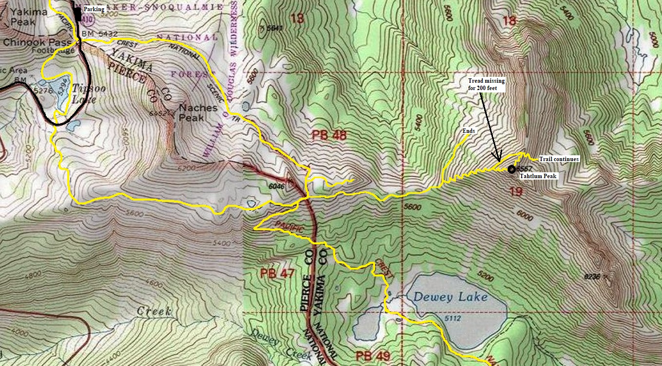
Take the Pacific Crest Trail south around Naches Peak. At the highpoint on the ridgeline, drop down toward Dewey Lakes just a little to a major jumble of trails. Look for a trail going left and downhill. This minor trail skirts below some cliffs on the ridge in the direction of Tahtlim Peak. Follow the trail traversing down and then up to the ridge going directly toward Tahtlum. When reaching the steep ridge of Tahtlum, after climbing about 200 verticle feet, the trail splits. The main trail/bootpath traverses NE while the climbers trail cuts right up the ridge, ending at the summit.


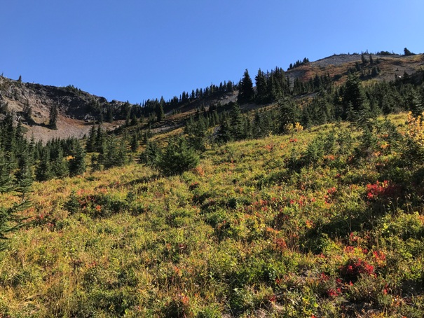
Starting up Tahtlum Peak, looking back at Yakama Peak and Mt. Rainier


Trails in yellow although there are many other trails and paths in the area.
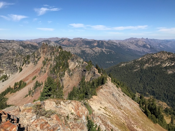
Looking North
Looking East. It was October 3rd and the snowpatch in the bowl made it through the summer.
Looking South and West toward Mt. Rainier
Comfortable flat area at the summit
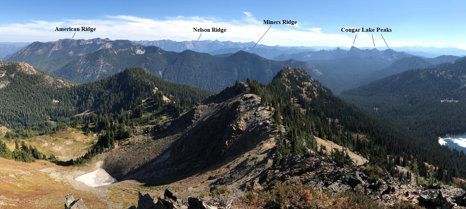
Looking north (see larger view at bottom of page)
The trail on the NW side of the mountain ended in this basin.
Traversing the ridge between PCT and Tahtlum Peak
Tahtlum Peak from the knob on the ridge near the PCT
On the trail near Chinook Pass, looking at the peak on the right.
The trail that goes over the north ridge just below the summit (about 3 contours down).


